
Flight Plan (Waypoints)
The Flight Plan tab is where you build your route. It supports up to 200 waypoints plus an optional start point. When auto-calculation is enabled, heading, distance, time en route, and fuel remaining are computed automatically for kneeboard rendering.
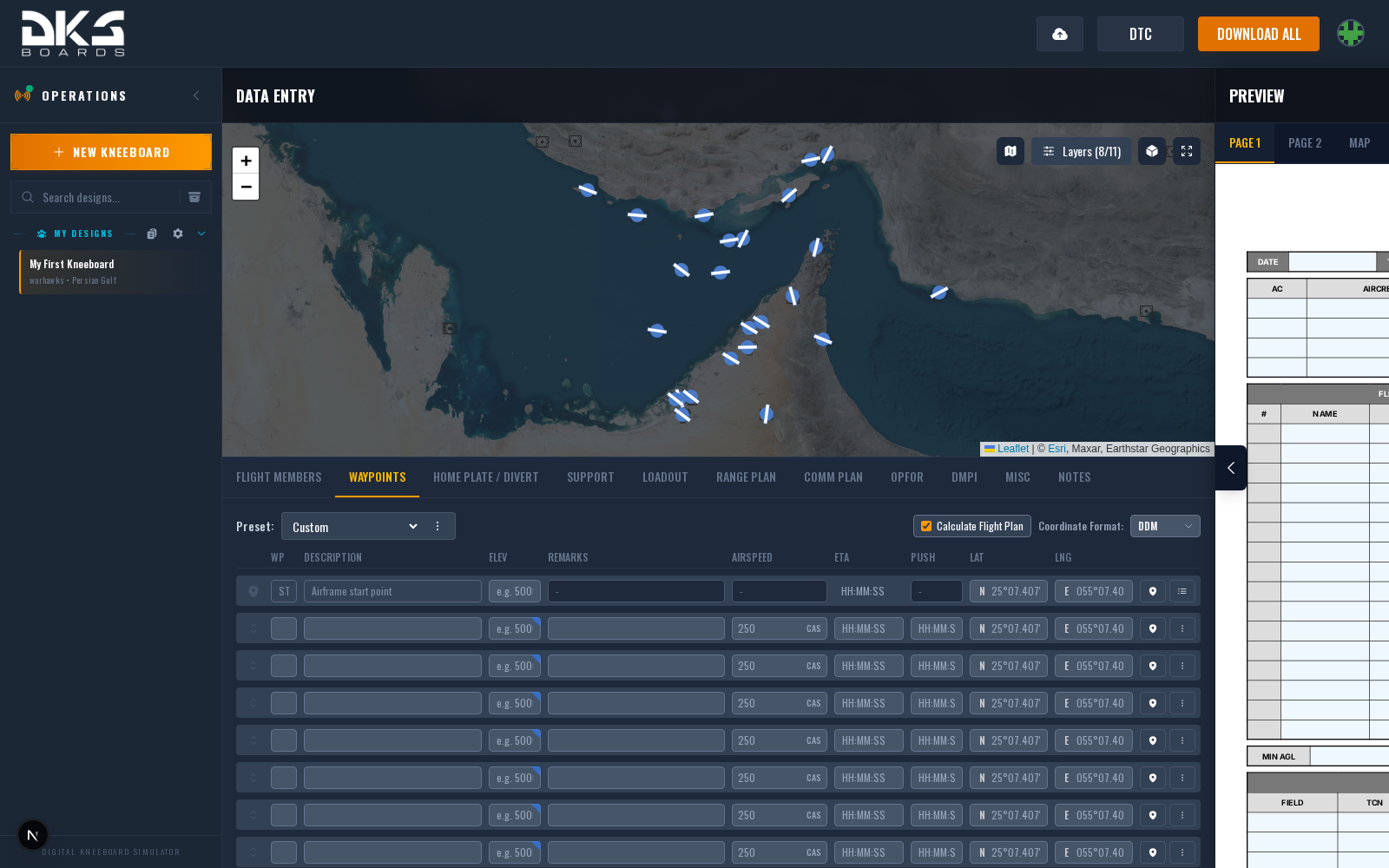
Start Point
The start point defines where your flight begins (typically the departure airfield). It sits above the waypoint grid.
| Field | Description | Example |
|---|---|---|
| Latitude | Start point latitude. Click the map to set, or type manually. | N 41° 12.345' |
| Longitude | Start point longitude. | E 043° 45.678' |
| Elevation | Airfield elevation in feet MSL. | 5800 |
| TOT | Time of Takeoff — when the flight departs. | 06:30 |
| Comm Preset | Communication preset number active at takeoff (1–20). | 1 |
Waypoint Fields
Each waypoint row has these fields. Drag the handle at the left edge to reorder rows.
| Field | Description | Example |
|---|---|---|
| WP | Waypoint sequence number. Drag rows to reorder. | 1 |
| Type | Waypoint type. Options vary by aircraft — for example, F-16C uses STPT, TGT, IP, OA, VIP, VRP, and others. Only visible when the selected aircraft defines waypoint types. | STPT |
| Description | Descriptive label for the waypoint. | IP NORTH |
| Elev | Waypoint elevation in feet MSL. Click the terrain icon to set a separate flight altitude used for calculations when different from ground elevation. | 6200 |
| Remarks | Freeform notes for this waypoint. | Fence in |
| IAS | Indicated airspeed for this leg in knots. When Calculate Flight Plan is on, this can be auto-filled based on the aircraft's cruise speed. | 350 |
| ETA | Estimated time of arrival at this waypoint. Auto-calculated when Calculate Flight Plan is enabled, or enter manually. | 06:45 |
| PUSH | Push time — when to depart this waypoint. Used for hold points where the flight arrives early and waits. | 06:50 |
| Preset | Comm preset number (1–20) for timeline integration. Only visible when the design uses timeline fields. | 3 |
| Lat / Lng | Waypoint coordinates in the selected format. Paste MGRS or any coordinate format and it will be auto-detected and converted. | N 41° 15.123' / E 043° 50.456' |
The waypoint actions menu (three-dot icon on each row) provides access to: select from theater locations, reposition relative to another point, configure popup attack (aircraft-dependent), advanced options, and delete.
Fuel plan row
In a waypoint's advanced options, Fuel plan decides whether the point prints on the fuel plan table with the continuation fuel needed there: the least fuel you can arrive with and still fly the rest of the plan and land at your minimum. By role (the default) puts task, task-end, hold and tanker points on the plan, and the landing point always closes it; Always and Never override that for a single waypoint.
Auto-Calculated Fields
When Calculate Flight Plan is enabled (checkbox at the top of the tab), the following fields are computed automatically and rendered on kneeboard templates:
| Field | Description | Example |
|---|---|---|
| HDG | Magnetic heading from the previous waypoint to this one. | 045° |
| Dist | Distance from the previous waypoint in nautical miles. | 23.4 NM |
| ETE | Estimated time en route from the previous waypoint. | 3:21 |
| Fuel | Estimated fuel remaining at this waypoint. Uses an aircraft-specific fuel burn model based on airspeed, altitude, and gross weight. | 4,200 lbs |
These calculated values appear on the exported kneeboard, not in the waypoint grid itself. Auto-calculation uses great-circle distance and theater magnetic declination. Aircraft with fuel burn models (F-16C, F/A-18C, AH-64D, OH-58D, and others) provide per-leg fuel estimates.
Coordinate Formats
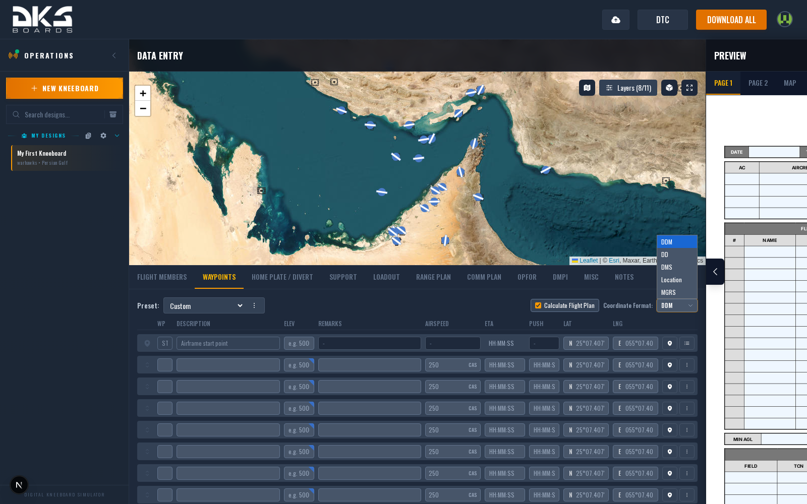
Use the format selector at the top of the tab to switch between:
- DDM — Degrees and decimal minutes (N 41° 12.345'). Default.
- DD — Decimal degrees (41.205750)
- DMS — Degrees, minutes, seconds (N 41° 12' 20.7")
- Location — Pick from a theater-specific location database (airfields, waypoints, etc.)
- MGRS — Military Grid Reference System (38T KM 1234 5678)
You can paste coordinates in any format into any field — the parser auto-detects DD, DDM, DMS, and MGRS input regardless of the selected display format.
Map Integration
The tactical map on the right side stays synchronized with the waypoint grid.
- Click a waypoint marker on the map to select it, then click elsewhere to reposition.
- Ctrl+Click (or Cmd+Click on Mac) on empty map space to add a new waypoint at that location.
- Drag waypoint markers on the map to reposition them.
- Right-click a waypoint marker for a context menu with options: reposition, popup attack, calculate viewshed, copy coordinates, and delete.
- Alt+Click on the map to enter measure mode.
Edits in the grid update the map and vice versa.
Weapons Delivery
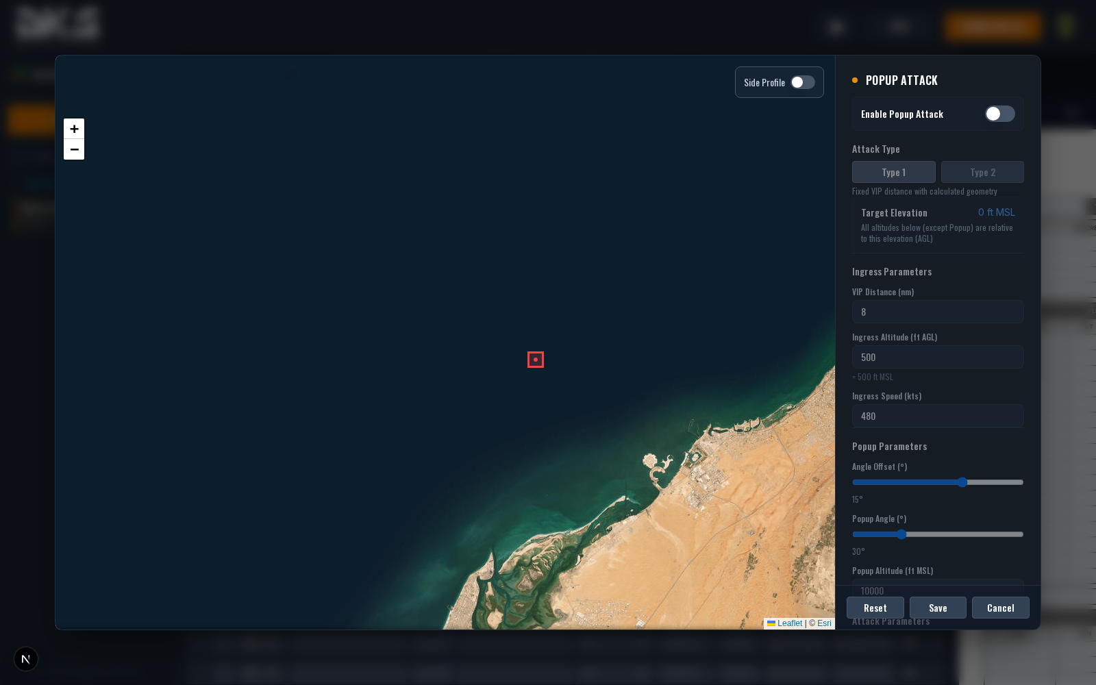
The weapons delivery planner computes attack-card geometry for popup, HADB, and TOSS profiles, including dive angle, release altitude, and pull-off geometry.
Access it two ways:
- Right-click a waypoint marker on the map and select "Weapons delivery..."
- Waypoint actions menu (three-dot icon) on a waypoint row — visible when the selected aircraft supports attack planning (including F-16C, F/A-18C, and AV-8B)
Package Flight Roles
When your design is a flight within a package, each waypoint gains a Role selector with options: Task, Ingress Hold, and Egress Hold. These tell the package timeline system how each waypoint fits into the overall mission flow.